PAGASA hoisted no tropical cyclone wind signal over Panay Island at any point in the 2023 season. On one Wednesday afternoon in July 2025, 88 of Iloilo City’s 180 barangays went under water, and the city disaster office’s account names persistent rains and no tropical cyclone. In August 2026, 56 barangays flooded across all seven districts, on what the Emergency Operations Center attributed to the southwest monsoon.
Those facts are the article. Storm exposure here is a water problem on a season rather than a wind problem on a calendar, and the decision that moves it most is the address on the lease. So this page runs the clock backwards, from where you have least control to where you had most.
When the Water Is Already at the Door
Iloilo City publishes an emergency hotlines directory stamped updated 15 December 2025, and the number that reaches the body actually deciding things is the Iloilo City Operations Center, 09190662333.
The disaster office’s rescue line, listed as ICER and USAR, is 09190661554, plus landlines (033) 339 7171, (033) 333 2333 and (033) 335 1554. Fire search and rescue is 09660520061, and 911 works nationally. Take the police line from the police: the directory table gives (033) 335 0299 and the site’s own call widget gives (033) 337-0400, while the Iloilo City Police Office’s release of 18 August 2026 gave (033) 335-0299 and 0908-377-0194. The Coast Guard is not on the directory at all, and coastguard.gov.ph returned HTTP 403 on 20 August 2026, so a port city has no published sea-rescue number.
Expect the utilities to go quiet rather than informative. MORE Power publishes a 24/7 hotline and a commitment to deploy “six (6) response teams round the clock”, and no restoration time for an unplanned outage anywhere on its site. Its Power Advisories page carried nothing newer than 8 June 2025 when read on 20 August 2026, straight through the flood nine days before this page. Its live channel is Facebook. Metro Pacific Iloilo Water sends outage updates by email and SMS only to the customer whose details it holds, which on a joint account is the landlord unless you register your own mobile.
If you cross the Iloilo Strait, the boats stop before the roads do. Coast Guard Memorandum Circular No. 02-13 allows no vessel of any type or tonnage to sail, “except to take shelter, as the situation may warrant”, once signal number 1 or higher is hoisted within its point of origin, its intended route and its point of destination. The circular still defines only PSWS Nr 1 to Nr 4 on the pre-2015 wind bands, the same staleness EO 66 carries. Our Iloilo transport guide sets out the nine-condition carve-out.
The Morning Call: Who Suspends What Here
Executive Order No. 66, s. 2012 sets the national rule, and Section 2 is the part Iloilo City actually uses. It lets local chief executives, as chairmen of the local disaster council, suspend classes and government work “in the absence of typhoon signal warnings from PAGASA”, in flood-prone or high risk areas. It also sets the clock: announcements no later than 4:30 a.m., or 11:00 a.m. for the afternoon session.
Two worked cases from nine days before this page was written. On 18 August 2026 there were no classes in Iloilo City, public or private, kindergarten to college, broader than any signal-triggered rule requires, on a monsoon flood with no cyclone. On 19 August the Emergency Operations Center recommended shifting preschool to senior high to alternative delivery modes, “particularly in flood-prone and highly vulnerable areas”. The city made both calls.
Where you see it is the awkward part. The disaster office’s site carries no news feed and embeds Facebook instead, under the heading “ARE YOU INFORMED?” The main city site has no advisory section. A suspension surfaces on Facebook first.
The Night Before: What PAGASA Actually Published
A wind signal forecasts mean wind over a wide area, and it is the number most often over-read. PAGASA last changed the five-signal system in March 2022, to harmonise it with the Philippine typhoon damage scales.
| Wind signal | Mean wind | Lead time | Automatic suspension under EO 66 |
|---|---|---|---|
| No. 1, strong winds | 39 to 61 km/h | 36 hours | Pre-school classes |
| No. 2, gale-force | 62 to 88 km/h | 24 hours | Pre-school, elementary, secondary |
| No. 3, storm-force | 89 to 117 km/h | 18 hours | All levels including graduate school, plus all government offices |
| No. 4, typhoon-force | 118 to 184 km/h | 12 hours | As No. 3 |
| No. 5, typhoon-force | 185 km/h or higher | 12 hours | As No. 3 |
Three qualifications belong with it. Signals may skip levels, so No. 1 can become No. 3 with no No. 2 between. They are hoisted at provincial or sub-provincial scale, wider than the area you live in. And PAGASA’s own FAQ page still served the pre-2022 bands on 20 August 2026, contradicting three other PAGASA sources.
For this city the rain warning matters more, and PAGASA’s published legend is thinner than it looks. The page renders three rainfall tiers named by consequence and nothing else: Advisory, where “Flooding is POSSIBLE in low-lying areas and near river channels”, Alert, where it is threatening, and Emergency, where severe flooding is expected. No millimetre figure sits against any of them. The older Heavy, Intense and Torrential table, with its 7.5, 15 and 30 mm thresholds and its instruction to evacuate, is still in that page’s source but wrapped in an HTML comment, so it never renders and we do not cite it as published. The measured number came from the city: the Emergency Operations Center’s report, carried by SunStar Iloilo on 18 August 2026, recorded rainfall averaging 70 mm per hour and 160 to 165 mm over six hours, with sensors triggering a “violet, or extremely torrential” alert, a tier PAGASA’s legend does not carry. Those two rainfall figures do not reconcile with each other: 70 mm an hour held for six hours is 420 mm, not 165. We publish the report as quoted rather than picking the half that suits, and read the hourly figure as a peak somewhere inside the six hours rather than an average across them.
One structural limit on warning. PAGASA’s legend describes basin-specific flood bulletins as issued by river basin centres “like Pampanga, Agno, Bicol, Cagayan and Cagayan De Oro”, an example list rather than a closed one, and names no Panay basin. What reaches Iloilo is the General Flood Advisory, issued regionally through the NDRRMC at 7:00 a.m. and 7:00 p.m. A Western Visayas advisory twice a day, not a river level for the Jaro.
Two Days Out: Where You Would Actually Go
Iloilo City does name evacuation locations, in a place no resident would look. The Contingency Plan for Typhoon of 10 January 2022 carries a barangay-by-barangay table for the 22 barangays it treats as exposed to typhoon and storm surge: Jaro Gym for Balabago, Bakhaw Integrated School for Bito-on, Philippine Science High School for Ingore. A table inside a PDF, with no map and no entry on the office’s sitemap.
The city states the limit itself. Its Disaster Risk Reduction and Management Strategic Plan 2022-2025, as of 22 November 2024, lists “No identified city evacuation center” under vulnerabilities and “Identified evacuation centers per barangay” under capabilities in the same matrix, and targets one standard centre per district against a baseline of zero, funded at PHP 10,000,000. That plan period ended in 2025 with no successor.
Practice matched the plan. During the August 2026 flood the city ran 13 evacuation centres, and the ones SunStar Iloilo named on 18 August were the Balabago chapel and day care centre, the Calubihan chapel in Jaro and the Bakhaw covered gymnasium in Mandurriao. Barangay buildings, borrowed. Find your barangay hall and the nearest school or covered court now, because nobody publishes which gets used on the day.
Before the Season: The Lease, the Deposit and the Shopping
The Philippine Civil Code does more for a renter here than any checklist, and Article 1654(2) is where it starts.
Read your lease for the stipulation, because those protections are defeasible by contract and Article 1174 says so in terms. How often Philippine leases actually shift storm damage onto the tenant is not something anyone publishes, so we describe the mechanism and claim nothing about frequency. Our Iloilo renting guide covers the rest of the contract.
In a condominium the boundary is statutory. Republic Act 4726 Section 6(a) makes the unit “the interior surfaces of the perimeter walls, floors, ceilings, windows and doors” and puts roofs, lobbies, lift shafts, tanks, pumps and risers outside it, so storm damage to those is common-area damage. The Act imposes no duty to insure: Section 9 says the declaration of restrictions “may also provide” for it. What your building owes you sits in the master deed, which you are not party to, so escalate through the lessor.
Insurance is shorter than it looks. The Insurance Commission’s published schedule of rates sets a minimum rate of 0.05 percent for typhoon and flood cover, names no base for that rate, and adds a mandatory deductible of 2 percent of actual cash value per occurrence, with contents flood cover only alongside typhoon cover. The deductible is the finding: it makes small losses uninsurable in practice. No Philippine insurer published a retail contents premium we could load on 20 August 2026.
On supplies, one useful rule and one gap. Under Republic Act 7581 as amended, prices of basic necessities freeze automatically once an area is declared under a state of calamity, for up to 60 days and with no separate order needed. Republic Act 10623 makes “potable water in bottles and containers” and candles basic necessities, so both are auto-frozen; batteries are prime commodities and are not. DTI’s bulletin effective 11 May 2026 is national, and puts a Wilkins 7L at PHP 90.00. Power banks, rechargeable fans and generators fall in neither category and have no published Iloilo City price at any tier, so we publish no band.
Before the Lease: The Address Is the Decision
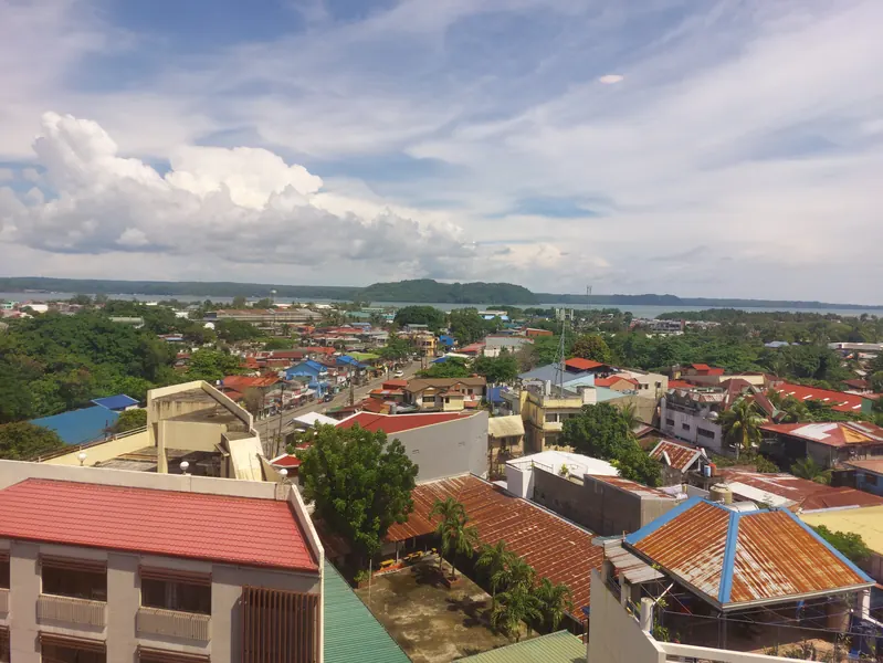
Iloilo City is a plain. JICA puts the average elevation at 3 metres above sea level and the city’s own contingency plan puts 90 percent of its landmass at 2.637 metres. The Iloilo River is not what drains it: DENR’s Environmental Management Bureau Region VI states the river “is actually an estuary” running from Oton through Lapuz, La Paz, Mandurriao, Molo and Arevalo, that it “has no watershed of its own”, and that its water comes from three creeks, runoff and seawater pushed in from the strait. The same page gives its length twice: “around more or less 10 km” in the prose, 26,715.05 m in the River Profile box.
Two flood mechanisms operate here, and the funder draws the line between them itself. JICA’s ex-post evaluation of the Iloilo Flood Control Project, an ODA loan executed by DPWH, records that since completion “there has been no single flood associated with heavy rains or typhoons (disasters associated with river flooding such as that of Iloilo River, Jaro River, Aganan River and Tigum River)”, and in the next sentence that “the city continues to experience flooding from drainage and small rivers (inland flood) in parts of the project area in Iloilo City and Pavia Municipality, which needs to be addressed in both cities”. The project built a 4.8 km floodway on the Jaro River with four bridges, completed April 2012, against a 20-year return period flood. A 50-year standard was deferred to a follow-on DPWH was still formulating at the 2014 evaluation, and nobody has established it was built. The second mechanism, the one JICA records as still needing to be addressed and for which DPWH was still only formulating a master plan at the 2014 evaluation, is the one that reaches an ordinary ground-floor unit.
Typhoon Frank in June 2008 is still the reference event, and it is where the jurisdiction trap lives. The works were still being built when it arrived: JICA records that Frank “damaged the structures such as riverbank protection walls that were being improved at the time”, adding roughly 2.8 billion yen to the cost, so the project was not protecting the city that year. JICA also records that Frank “was said to be a 50-year return period typhoon”, a hedge we keep because JICA wrote it.
| Jurisdiction | Deaths | Source |
|---|---|---|
| Philippines | 557 | NDCC Situation Report No. 33, 31 July 2008; casualties as of 24 July 2008, stated to exclude the MV Princess of the Stars |
| Western Visayas (Region VI) | 430 | Same report, regional subtotal |
| Iloilo province | 105 | Same report, provincial subtotal |
| Iloilo City | 26 | City Social Welfare and Development Office final report, as reported by the Philippine Star, 16 June 2011 |
| Iloilo City | 28 | Iloilo City Contingency Plan for Typhoon, 10 January 2022, which states 28 dead and 170 injured |
The affected-population figures split three ways. NDCC’s Iloilo City row as of 24 July 2008 gives 152 barangays and 261,355 persons; the city welfare office’s final report, as reported by the Philippine Star, gives 418,000 across all 180 villages, which the Star reports as about 63 percent of the population, a share that cannot be the city’s: 418,000 is roughly 91 percent of the 457,626 the 2020 census counts, and the city was smaller in 2008 than it is now, so 63 percent implies a denominator near 663,000 that belongs to no Iloilo City figure we can find; the city’s own contingency plan gives 50,873 families and 254,275 persons. Three city-scoped counts on three dates, none reconciled anywhere, so we carry all three. NDCC is also specific on utilities: one collapsed bridge carrying the main line cut 70 percent of the water district’s supply, and repair was put at four to six months.
No rainfall total and no wind reading for Iloilo City during Frank ships here. PAGASA’s annual report archive does not reach 2008, the UP NOAH page on the Frank flood refuses connections, and the figures in circulation have no primary carrier.
On the coast, the same city plan states that “Twenty one barangays with about 96,750 people are located along the shorelines”, while its own exposure table lists 22. Its worst-case scenario assumes winds of 250 km/h gusting to 300 km/h, so the city plans against a Signal No. 5.
The city does publish an address-level map, on a page a renter would never think to open. The disaster office’s hazard maps page, stamped updated 8 July 2026, serves a Flood Hazard Map of Iloilo City as a single JPEG: GIS processing by OCDRRMO, data as of December 2024, drawn at 1:10000, with barangay boundaries and building footprints, shading the built-up city in four tiers from low to very high flood susceptibility. A storm surge sheet beside it maps inundation of more than 1 metre to 4 metres. Neither is searchable, so read them next to HazardHunterPH, run by DOST-PHIVOLCS under GeoRisk Philippines, which takes one address and returns Flood (MGB), Storm Surge (DOST-PAGASA) and Severe Winds layers at 20, 50, 100 and 200-year return periods. Run both before you sign, ask the landlord whether the unit has taken water, and read our Iloilo neighbourhood guide for the district record.
What Nobody Publishes About Iloilo’s Storms
Hazard writing is where a missing number gets filled in with a plausible one. Our methodology sets the rule this page follows. These are the figures we went looking for, and what came back.
| Source | What we asked it | Result | Date checked |
|---|---|---|---|
| PAGASA, Annual Report on Philippine Tropical Cyclones 2023 | a cyclone frequency or return period for Western Visayas, Region VI or Panay | Not published 75 MB PDF extracted and searched in full: zero occurrences of Western Visayas, Region VI or Region 6, and no regional return period. What it publishes is national, a 30-year normal of 20.4 cyclones entering the Philippine Area of Responsibility and 8.4 making landfall, reference period 1991 to 2020, plus the record that no wind signal was hoisted over Panay Island during the 2023 season | |
| PAGASA, Regional Severe Wind Hazard Maps | a return-period wind speed for Panay or Region VI | Not published a genuine return-period product exists at 20, 50, 100, 200 and 500 years, built from cyclone tracks entering the PAR from 1951 to 2020, but Regional here means regional-scale wind field and the published files are single national maps. No Region VI file and no extractable Panay figure | |
| PAGASA, Climatological Normals, Iloilo station | monthly rainfall normals for the Iloilo station | Found the station table on the climate-data page is static HTML with one direct PDF link per station. The Iloilo sheet is headed STATION: ILOILO CITY, ILOILO and PERIOD: 1991 - 2009, and gives rainfall month by month: February 36.3 mm the driest, July 361.2 mm the wettest, November 131.1 mm, December 124.2 mm, annual 2,085.1 mm over 132 rainy days. The period is 1991 to 2009 although the folder is labelled 1991-2020, which is a shorter run than other stations carry | |
| PAGASA, FAQs and Trivias | the current tropical cyclone wind signal bands | Stale still serving the pre-2022 scheme of 30 to 60, 61 to 120, 121 to 170, 170 to 220 and above 220 kph, contradicting PAGASA's own legend page, its learning-tools page and Table 1.3 of the 2023 annual report | |
| PAGASA, Legend, rainfall warning tiers | millimetre thresholds for the rainfall warning tiers | Not published the rendered page carries Advisory, Alert and Emergency by consequence with no millimetre figure against any of them. The Heavy 7.5 to 15 mm, Intense 15 to 30 mm and Torrential above 30 mm table is present in the page source but enclosed in an HTML comment, so it does not render. No other live PAGASA page found carrying those thresholds: /learnings/rainfall-warning returns 404 and /learnings/flood carries no threshold table | |
| Iloilo City CDRRMO, Hazard Maps | a downloadable city flood or storm surge hazard map | Found the page is stamped updated 8 July 2026 and lists four maps for drought, fire, flood and storm surge. All four JPEG files download; the flood sheet is 890 KB at 2,048 by 2,560 and is titled Flood Hazard Map of Iloilo City, GIS processing OCDRRMO, data as of December 2024, project scale 1:10000, CRS PRS92 EPSG:4683, with barangay boundaries, building footprints and four susceptibility tiers. It served HTTP 200 to two clients, including one sending no user agent | |
| Iloilo City Government | a flood-prone barangay list or an advisory section on the main city domain | Not published no news, advisory or ordinance section on the main site; the disaster office path returns 404 and a site search for flood returns only static navigation. The disaster office subdomain carries everything, including the hazard maps, and its own sitemap has no evacuation-centre page. This host also returned HTTP 403 to one client the same day | |
| SunStar Iloilo, Typhoon Tino coverage | an Iloilo City figure for Typhoon Tino, November 2025 | Not published the RDRRMC tallies are given for Western Visayas and broken out by the five provinces only, 42,555 families across the region of which Iloilo province 9,001. Iloilo City is never separately counted, and we do not synthesise a city figure | |
| Department of Education, DepEd Order No. 37, s. 2022 | the modern rule on automatic class cancellation by wind signal | Blocked (403) HTTP 403 to every method for both the PDF and its landing page. The Region VI mirror fails certificate verification, the Region VIII reiteration memo is a nine-page scan with a zero-byte text layer, and five division mirrors returned 404 | |
| UP NOAH Center, Frank (2008) Flood in Iloilo | rainfall totals and inundation depth for Iloilo City during Typhoon Frank | Timed out connection refused at the host on two attempts by two clients, zero bytes returned. This was the strongest remaining lead for a Frank rainfall figure and it could not be opened | |
| Philippine Coast Guard | a national or Western Visayas district emergency number | Blocked (403) HTTP 403 on every path tried, and the Western Visayas district subdomain does not resolve. The city's own hotline directory does not list the Coast Guard either | |
| MORE Power, Power Advisories | a restoration commitment or a live storm outage advisory | Stale the page loads and carries exactly four advisories, newest dated 8 June 2025, all scheduled or NGCP maintenance and none weather-related. No time-bound restoration commitment on this page or on the Commitments and FAQ pages | |
| Insurance Commission, published schedule of rates | a regulator-published rate or condition for typhoon and flood cover | Found filed under an earthquake filename and carrying the allied perils schedule: a 0.05 percent minimum rate for typhoon and flood with no base stated, a mandatory 2 percent deductible per occurrence, and contents flood cover only alongside typhoon cover. The schedule carries no revision date on its face, so it is dated as retrieved |
- Blocked (403)
- refused an automated fetch; not the same as not published
- Found
- the source published the figure
- Not published
- the source exists and does not publish this figure
- Timed out
- no response; not the same as not published
- Stale
- publishes a figure superseded by a later cycle
The Bottom Line
Iloilo City’s storm risk has been partly engineered down and partly not, and which half you get is set by the address. The river flooding that made Frank a catastrophe has not recurred since the floodway completed in April 2012. The drainage flooding the same evaluation says still needs to be addressed put 88 barangays under water in July 2025 and 56 in August 2026, and no source we could open attributes either to a tropical cyclone.
The Cebu contrast is about mechanism, not climate. Our Cebu typhoon guide is written around named waterways and a wind event; this one around drainage and a season. On the labels the two cities are closer than they look. PAGASA’s amended onset criteria list the Iloilo station under Climate Type I, which its 1951-2010 climate map defines as “Two pronounced season, dry from November to April”. The same map puts that Type I band over Antique and the south-west of Panay and shades the rest of Iloilo province Type III, the class it gives Cebu. The station’s own normals settle the practical question: 131.1 mm in November is not a dry month.
What that leaves a renter is short. Run the address through the city flood hazard map and HazardHunterPH before you sign, ask about water in the unit, read the repair clause against Article 1654(2), save the Operations Center number, register your own mobile with the utilities, and know which barangay building you would walk to. For the seismic side, our Iloilo safety guide carries the 1990 Panay earthquake at magnitude 7.1, a western Panay event rather than a city one.
FAQ
Frequently asked.
When is typhoon season in Iloilo City?
What does PAGASA Signal No. 1 mean for Iloilo City?
Which barangays in Iloilo City flood?
Who pays for typhoon damage to a rented condo in the Philippines?
How many people did Typhoon Frank kill in Iloilo City?
Data note. Prices, rates, and details are verified as of publication and may change. Always confirm with the listed provider or landlord before committing. This article is informational, not financial, legal, or immigration advice. Full disclaimer.